
Last updated: August 16, 2026
A railroad bridge once crossed Green Bay’s East River near today’s Monroe Avenue and University Avenue, leaving little trace in the modern landscape.
Continue the story below ↓
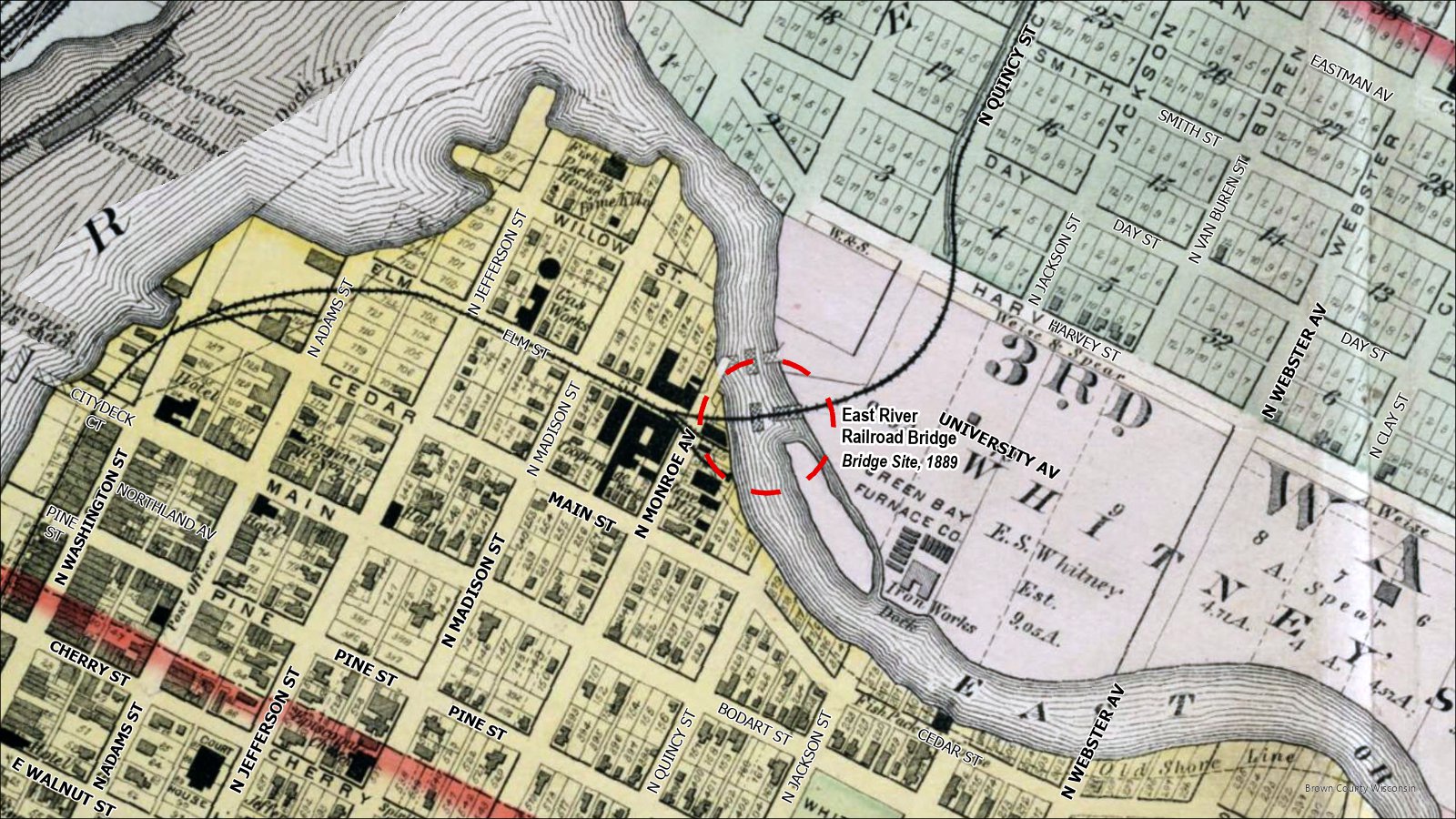
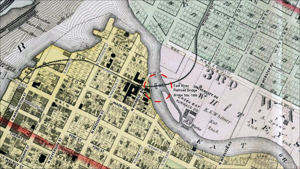
The railroad that used to cross the East River where Monroe Av & University Ave meet in downtown Green Bay. Credit: 1889 Plat Book of Brown County by C.M. Foote & Co
A Vanished Railroad Bridge in the Heart of Green Bay
The Hidden Story
Today, traffic moves through the busy intersection of Monroe and University Avenues with little hint of what once crossed the East River nearby. Old maps reveal a railroad bridge here, a vanished piece of Green Bay’s transportation history hiding beneath the modern city.
What We Know
An 1889 plat map of Green Bay shows a railroad crossing the East River near the present-day intersection of Monroe and University avenues. The bridge was part of a railroad landscape that once threaded through this part of the city.
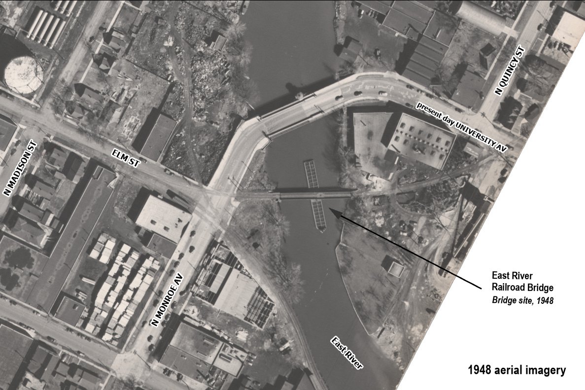
The 1948 aerial photograph captures an especially interesting moment at this crossing. The railroad bridge over the East River was a swing bridge, Monroe Avenue (today is University Ave) crossed the river on its own movable bridge. Both crossings had to accommodate traffic on land while still allowing navigation along the East River.
The old Monroe Avenue drawbridge survived for decades after this photograph was taken. According to the U.S. Coast Guard, it was replaced by the fixed bridge in 1984. Remarkably, the federal drawbridge regulation governing the old bridge remained on the books until 2025, when the Coast Guard finally removed the obsolete rule.
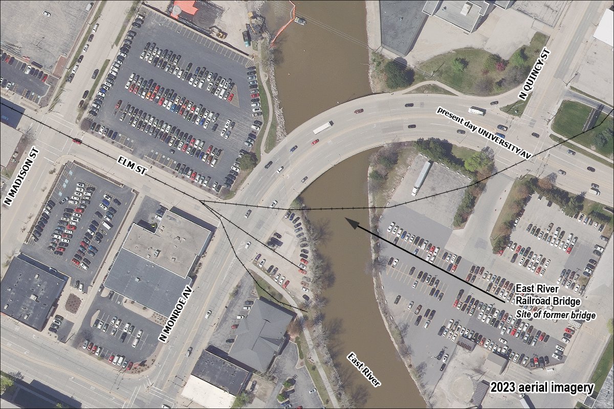
Today, the railroad and bridge are gone, and the modern street network gives little indication that trains once crossed the river here.
Why It Matters
This wasn’t an isolated railroad bridge. It was part of a much larger web of tracks that once crossed Green Bay. The line carried trains across the East River, connecting rail corridors on Green Bay’s east side with the sprawling railroad network across the Fox River around Fort Howard. Remove the old tracks from the map, and the bridge seems almost inexplicable. Put them back, and its location suddenly makes sense.
If You Visit
Best experienced: Historical Photographs
What You’ll See
Nothing of the old railroad bridge is left except for a few traces of pilings on the southwest side of the East River.
Best Viewpoint
Sidewsalk at Monroe / University / Elm St or the trail along the East River.
Access: Public
Accessibility
Mostly Accessible
Access Notes
The gravel parking lot next to the river is private property.
Contributors
Adventures in Place
 Adventures in Place