
Last updated: August 16, 2026
A quiet cut climbing a wooded hillside is a surviving trace of the Green Bay–Chicago Military Road, built during Wisconsin’s territorial era and later traveled by settlers and other travelers.
Continue the story below ↓
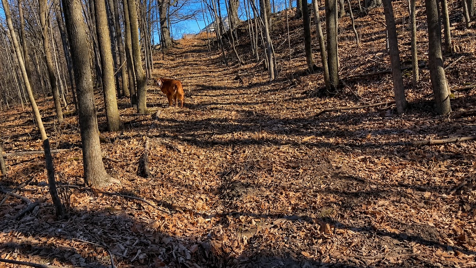
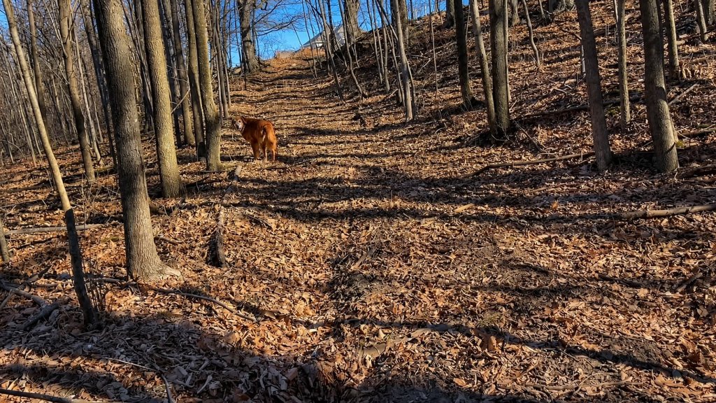
Sunny pauses on a quiet wooded path that follows the trace of the old Green Bay–Chicago Military Road. Credit: Adventures in Place
This quiet path through a woods in Ledgeview was once part of the main road from Green Bay to Chicago.
Explore This Story in the Interactive Atlas →
The Hidden Story
Walk into Hidden Woods Greenway in the Town of Ledgeview just outside of Green Bay today, and there is little to suggest that this quiet path through the trees was ever particularly important. It climbs a wooded hillside, covered in leaves and crossed by roots, looking much like any other old trail.
But look at its width. Look at the cut into the hillside. This wasn’t always just a path through the woods.
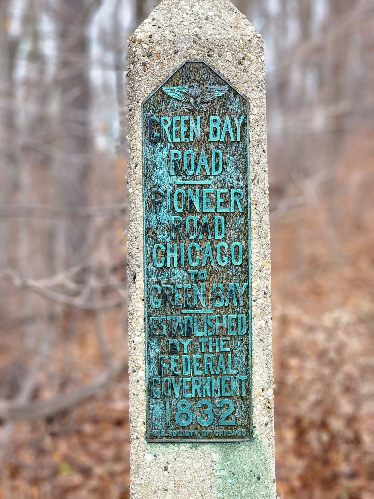
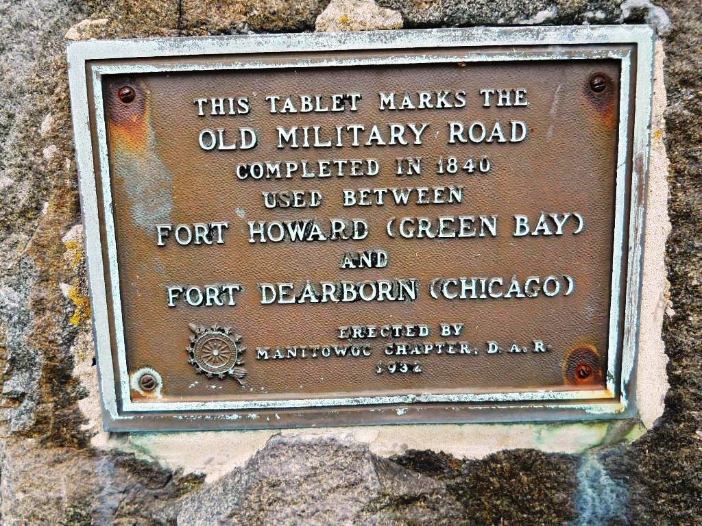
Nearly two centuries ago, travelers passed through here on the Green Bay–Chicago Military Road. Before modern highways connected the two cities, this was part of the road south from Green Bay toward Chicago.
The traffic is gone. The forest has returned. But the road itself has not entirely disappeared.
What We Know
The Green Bay–Chicago Military Road was established during Wisconsin’s territorial era as an overland route connecting Green Bay with Chicago. Although built as a military road, it also became a route used by settlers and other civilian travelers moving through early Wisconsin.
Historical maps and original land-survey records from the 1830s document the road through this area. In this area, the roadway was mapped according to the survey. Comparing those records with modern mapping and terrain data helps place the historic route on today’s landscape. You can watch the accompanying Adventures in Place YouTube video for more on how this story came together.
At Hidden Woods Greenway, that comparison leads to something you can actually see on the ground: a broad, road-like cut climbing the hillside along the historic alignment.
Much of the old military road has since been altered, absorbed into modern roads, returned to farmland, or reclaimed by woods. Here, however, the shape of the old route remains surprisingly legible.
Why It Matters
The surviving road cut is a rare place where an important early transportation route can still be read directly in the landscape. What now appears to be an insignificant wooded path once connected this area to a much larger network of travel, settlement and change.
Questions That Remain
How much of the visible road cut is actually part of the original military road?
Historical maps and survey records place the route through this area, but the traveled alignment may have shifted locally over time. Additional historical and terrain evidence may help refine exactly how the road crossed this hillside.
The Big Picture
What makes this place remarkable is the contrast between what it is now and what it once was.
Today it is a quiet wooded greenway. Once, this hillside was part of an important overland connection between Green Bay and Chicago.
Places like this remind us that old transportation routes do not always disappear. Sometimes they become modern roads. Sometimes they vanish beneath farms and neighborhoods. And sometimes they survive quietly in the woods, recognizable only when old maps and the modern landscape are brought back together.
Keep Exploring
There are traces like this scattered across the landscape, places where an ordinary path, field edge, or country road preserves something much older.
Once you learn to recognize them, the landscape starts to look different. A quiet walk through the woods can become a walk along a road traveled nearly two centuries ago.
Sometimes the past isn’t buried very deeply. Sometimes you can still walk on it.
If You Visit
A short walk through Hidden Woods Greenway in Ledgeview (just outside of Green Bay) leads to a surviving road-like cut along the historic Green Bay–Chicago Military Road alignment. Knowing what it once was transforms an otherwise quiet woodland path into a tangible piece of Wisconsin’s transportation history.
Best experienced: Hike
What You’ll See
Look for the broad cut climbing the wooded hillside. Fallen leaves and vegetation soften its edges, but its width and grade distinguish it from an ordinary footpath. The feature becomes much easier to recognize once you know you are looking for an old roadway.
Best Viewpoint
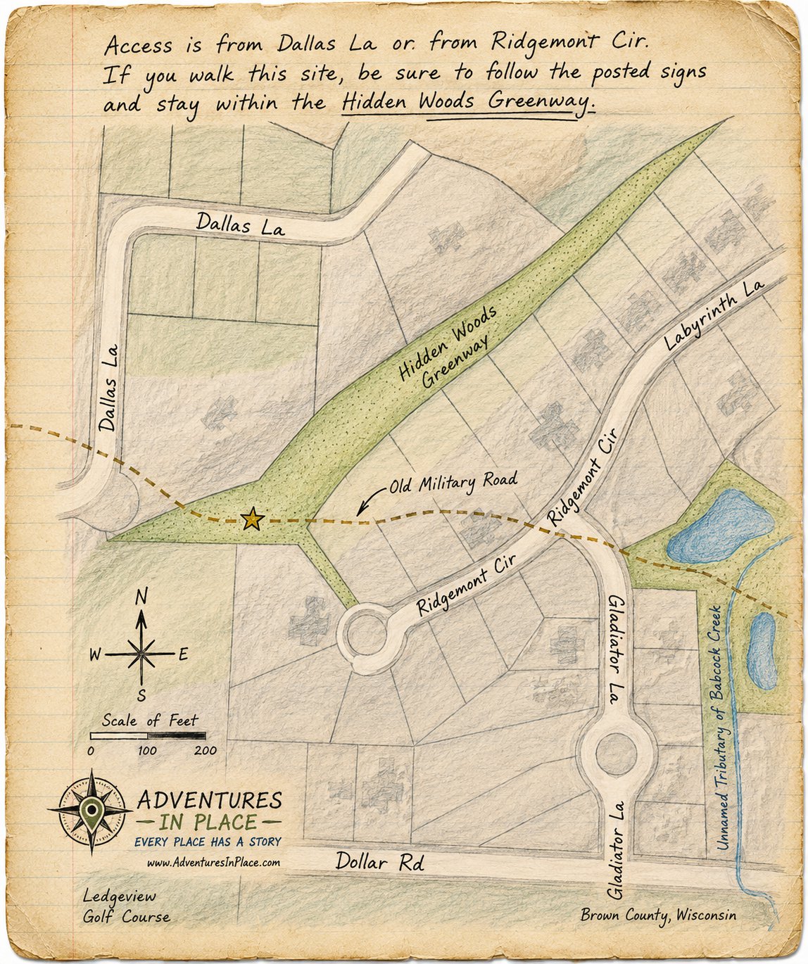
From within the old road cut while climbing the hillside, in the Hidden Woods Greenway (see site sketch map) where its width, grade, and relationship to the surrounding slope are easiest to recognize
Access: Public
Accessibility
Limited Accessibility
Access Notes
Unpaved woodland terrain with uneven footing, leaves, roots, and a moderately steep hillside. Conditions may vary seasonally.
Site Sketch Map
Explore This Story in the Interactive Atlas →
Contributors
Research and route reconstruction by Adventures in Place using original land survey records from the 1830s and 1840s, historic maps, modern GIS, and field observation.
 Adventures in Place